


This new generation of earth observation is of particular interest to agriculture, as Copernicus and its satellites Sentinel-1 (radar sensors) and Sentinel-2 (multispectral sensors) make it possible for the first time to examine various aspects of farming at field level in quick succession regard. Both environmental conditions, such as soil moisture, and plant growth itself can be continuously monitored and used to optimize and adapt land management. However, before the earth's surface scanned by the satellites can be used for practical agriculture in the form of radar and multispectral data, it is necessary it is an intensive scientific discussion in two steps. First, the raw data must be processed so that it can be used for specific applications; This includes atmospheric correction, geometric and radiometric correction, masking and assessment of cloud cover, calculation of vegetation indices, etc. In a second step, relationships between crop production observations and satellite data are systematically researched.
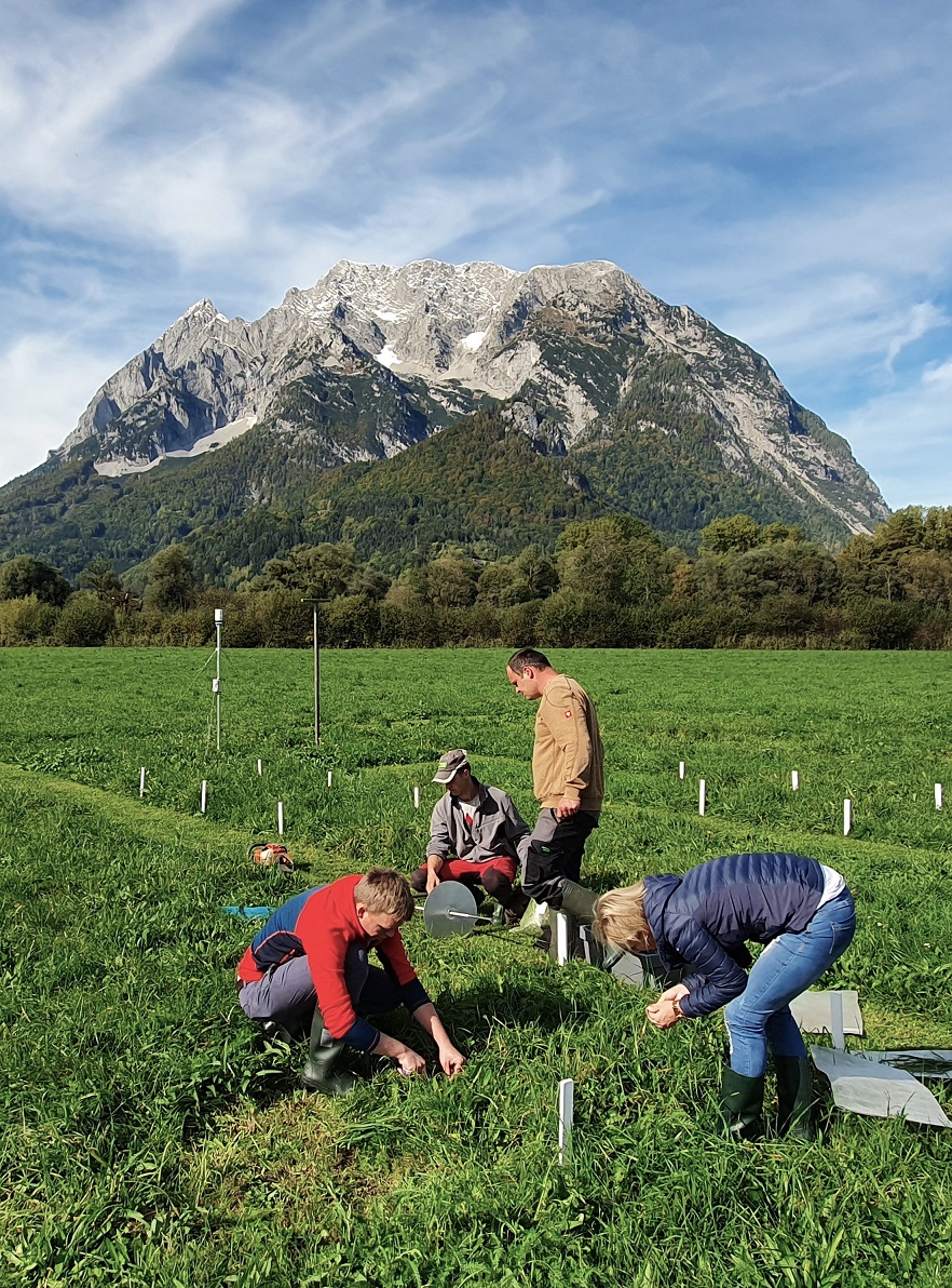
The SatGrass pilot study examined the connection between multispectral Copernicus satellite data and the qualitative and quantitative development of grassland stands. Using continuous destructive and non-destructive measurements repeated at weekly intervals on a specially designed grassland field test, embedded in a practical area, in combination with climatic influencing factors, it was checked whether and how well remote sensing data are suitable for the qualitative and quantitative description of the growth dynamics of grassland stands .
The two-year project was designed as a pilot study to better assess the scope of work, data collection options and the potential of the results. The aim was to use the experience gained to start a much more extensive research project.
Schaumberger, A. and Klingler, A. (2020): Use of remote sensing and climate data to describe yield and quality dynamics in grassland, final report, HBLFA Raumberg-Gumpenstein, Irdning-Donnersbachtal, 28 p.