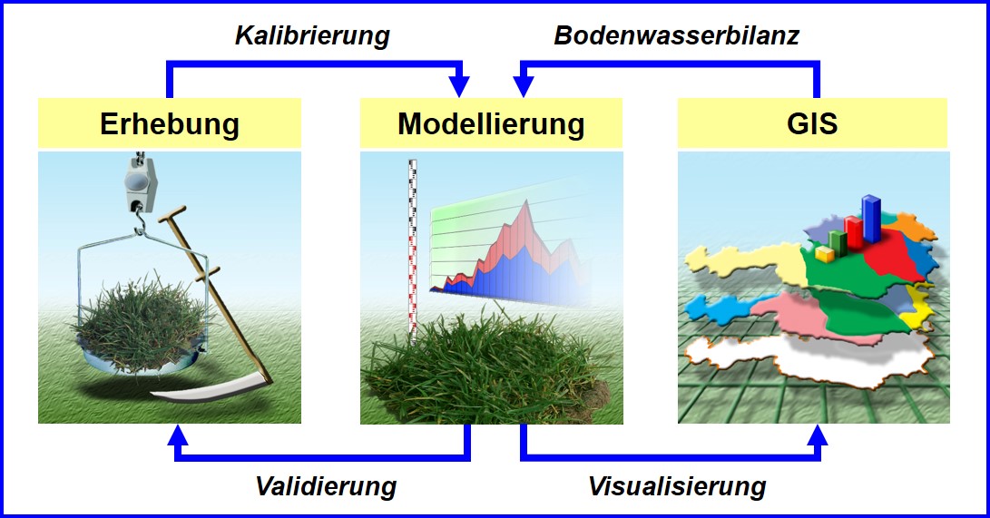
The results available are time series over several decades to describe the growing season (start, end and duration), soil water conditions, the occurrence of dry periods and grassland yields. The maps provided show risk regions for future negative developments in climatic conditions and can be used for strategic decisions or for the development of regional adaptation strategies in agriculture.
Schaumberger, A. and Daneu, V. (2017): Spatiotemporal monitoring of agro-meteorological parameters for Austria, final report, HBLFA Raumberg-Gumpenstein, Irdning, 132 p.


