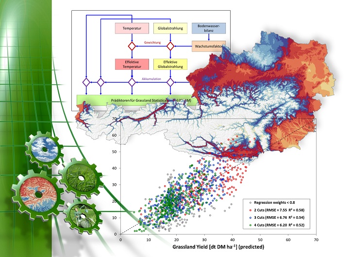
Yield data from experiments lasting several years at various locations in Austria were combined with weather and soil data in a GIS in order to establish a connection between yield and weather or water availability. A statistical model takes into account the possible water limitation and, taking temperature and radiation into account, estimates the growth-related grassland yields with a coefficient of determination of 0.63 and a mean error of 669 kg dry matter per hectare, which corresponds to a medium-strong connection. The model developed here is suitable for the regional representation of relative yield deviations of individual annual yields, especially in extremely dry years, to a long-term average.


